

Mostantól követi felhasználót
A felhasználó követése sikertelen.
Ez a felhasználó nem engedélyezte mások számára, hogy kövessék.
Ön már követi ezt a felhasználót.
Tagsági előfizetésével csak 0 követésre van lehetősége. Itt fejlesztheti tagságát.
Nem követi a továbbiakban felhasználót
A felhasználó követésének kikapcsolása során hiba lépett fel.
Sikeresen ajánlotta felhasználót
A felhasználó ajánlása során hiba lépett fel.
Valami hiba történt. Kérjük, frissítse az oldalt és próbálja újra.
E-mail cím hitelesítése sikeres.

lahore,
pakistan
Itt jelenleg ennyi az idő: 4:37 de.
Ekkor csatlakozott: július 13, 2017
0 Ajánlások
Muneeb A.
@MUNEEBAAMIR
0,0
0,0
0%
0%
lahore,
pakistan
N/A
Teljesített megbízások
N/A
Költségvetésen belül
N/A
Határidőn belül
N/A
Ismételt megbízási arány
Geospatial Expert
Keresse Muneeb A. felhasználót a munkájával kapcsolatban
Jelentkezzen be, hogy chaten keresztül megbeszélhessék a részleteket.
Portfólió
Portfólió


Preparation of Digital Elevation Model
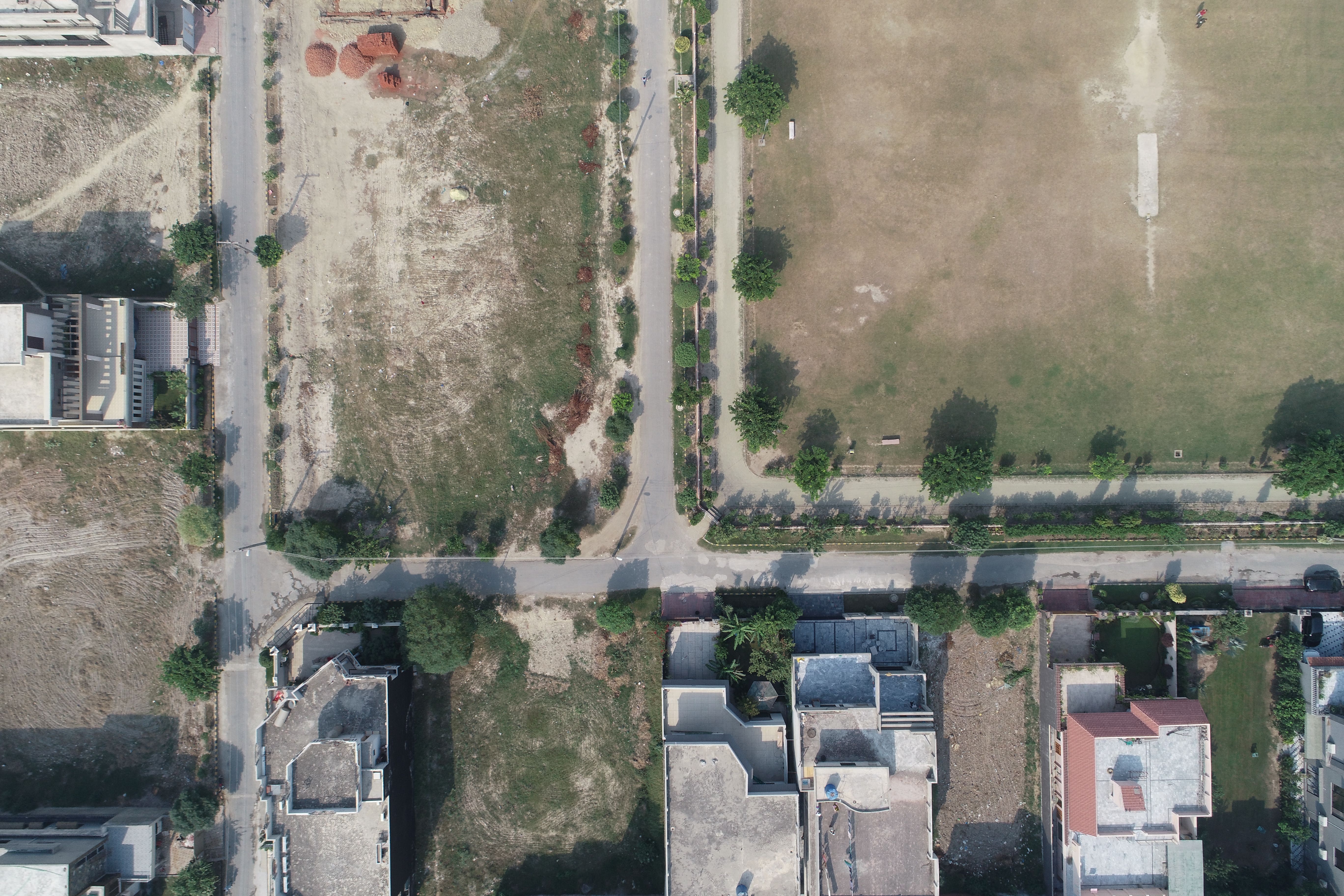

Drone Mapping

Drone Mapping

Drone Mapping
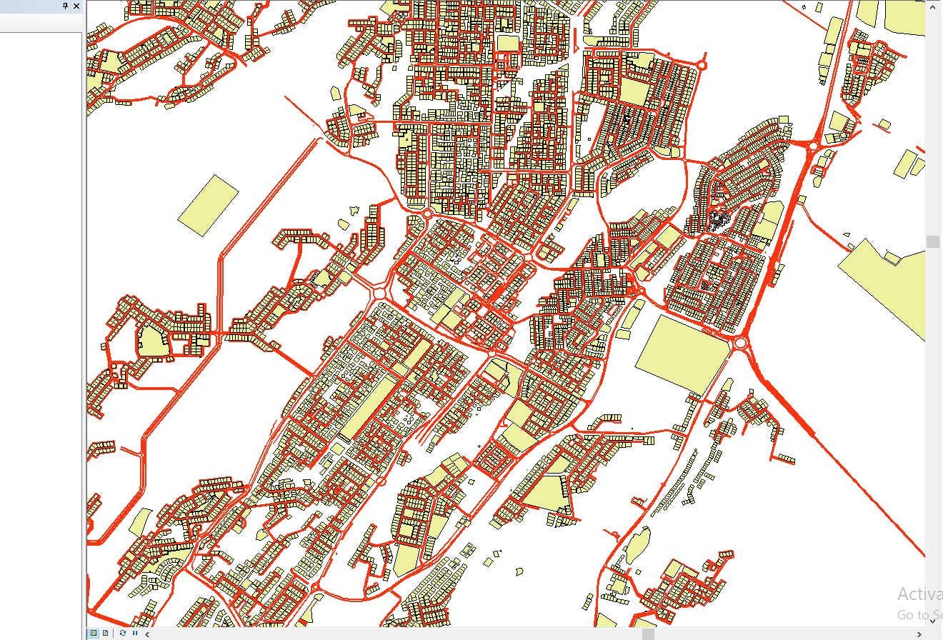

CAD to SHP Files

CAD to SHP Files
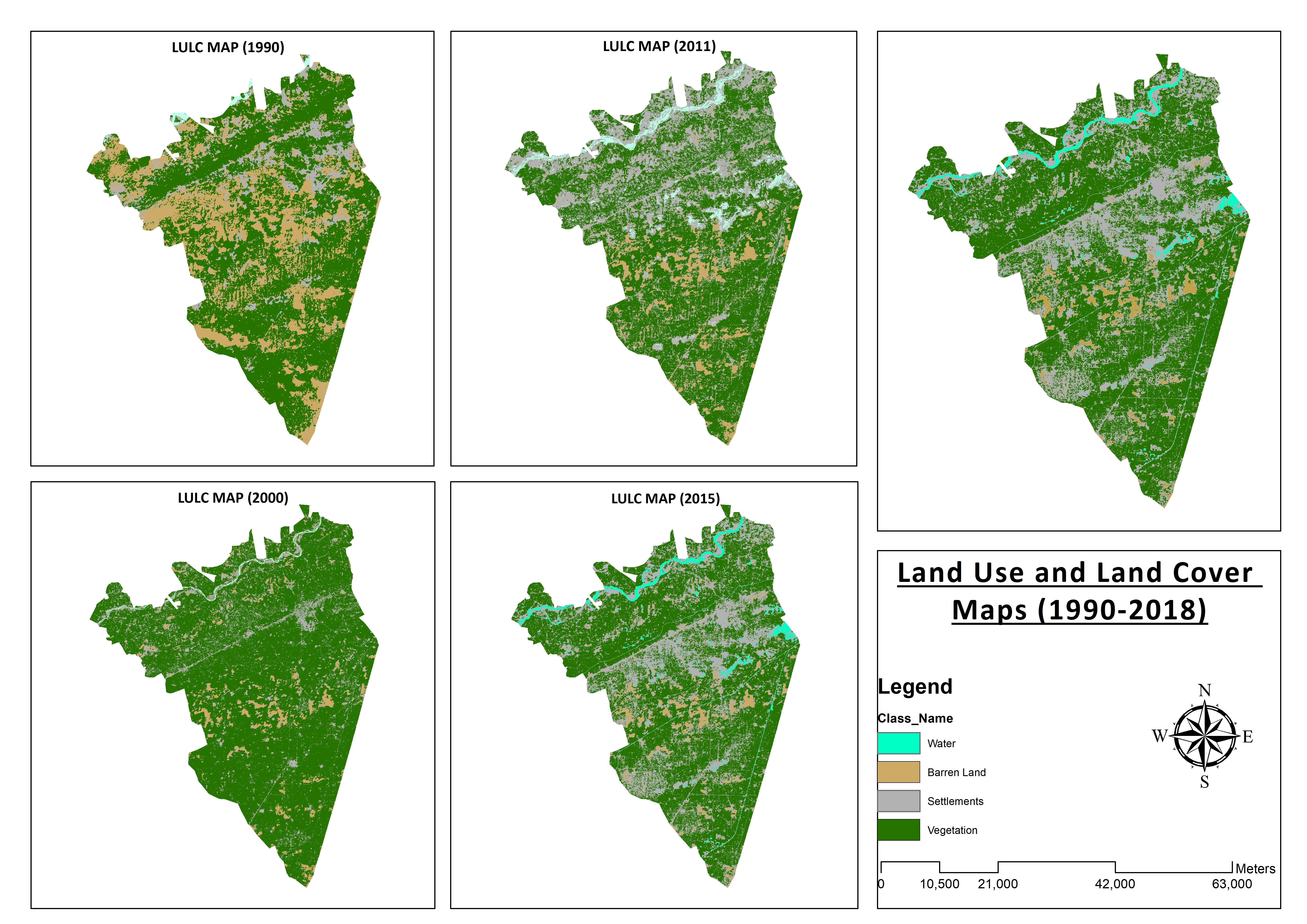

Land Use and Land Cover Maps
Preparation of Digital Elevation Model
Drone Mapping
Drone Mapping
Drone Mapping
CAD to SHP Files
CAD to SHP Files
Land Use and Land Cover Maps
Értékelések
Változtatások elmentve
Nincsenek megtekinthető értékelések!
Tapasztalat
Remote Sensing and GIS Analyst
szept. 2018 - okt. 2019 (1 év, 1 hónap)
Developed, integrated and Implemented GIS and Geodesy based Topographic Survey Plans under different Hydro-Power Projects in Northern Pakistan, Extension of Canal Projects to increase its capacity in Sindh-Balochistan, Analysis of Suitable Site Selection for different development sites by using Drone for Aerial Mapping and their detailed pre-feasibility studies with different softwares, to analyse and interpret spatial data to produce interacting Maps and Reports while ensuring quality control.
Research Associate GIS
okt. 2015 - okt. 2018 (3 év)
Deployed GIS-based system under Urban Immovable Property Tax (UIPT) for Punjab Excise & Taxation Department. Provided comprehensive support in creating the system while take advantage of software suites like ArcGIS Suite and ERDAS Imagine. Prepared communicating maps to help surveyors in Analyzing geo-spatial data to verify it during ground truthing. Created shapefiles to merge topographical data with external data through layering process.
Tanulmányok
Master of Philosophy in Geographic Information System
(2 év)
Bachelors in Geographic Information System
(4 év)
Végzettségek
MS-Office
TEVTA
2017
MS-Office Certification in MS-Word, Excel and Power Point.
Publikációk
Analysis of Flood Damage Assessment through Different Satellite Datasets in Southern Punjab,Pakistan
International Journal of Innovations in Science & Technology
RS and GIS techniques can achieve the objectives and significant analyses through visual interpretations. These techniques are also used to identify the flood affected regions. The study site was examined by applying supervised classification determining that 16900.96 Hectors of agriculture land was damaged while Sparse Riverine Forest had the area 44.52 hectors. The damaged built-up area was 1805.78 Hectors.
Estimation of Net Rice Production by Remote Sensing and Multi Source Datasets
Sarhad Journal Of Agriculture
Estimation of net crop production before harvest enables agronomists and decision makers to determine the volume of grain precisely. Yield estimation is one of the challenging tasks which is significant to evaluate accurately for farmers. This research was conducted in eastern Punjab Pakistan by incorporating yield/area as reported by Crop Reporting Service Department along with open source satellite datasets.
Keresse Muneeb A. felhasználót a munkájával kapcsolatban
Jelentkezzen be, hogy chaten keresztül megbeszélhessék a részleteket.
Hitelesítések
Kiemelt készségek
Hasonló szabadúszók keresése
Hasonló bemutatók böngészése
Meghívó sikeresen elküldve!
Köszönjük! E-mailben elküldtük a linket, melyen átveheti ajándék egyenlegét.
E-mailje elküldése során valami hiba történt. Kérjük, próbálja újra.
A vágólapra másolás sikertelen volt. Kérjük, jogosultságai módosítását követően próbálja meg újra.
Vágólapra másolva.
Előnézet betöltése
Hozzáférést adott a helymeghatározáshoz.
Belépési munkamenete lejárt, és kijelentkeztettük. Kérjük, lépjen be újra.